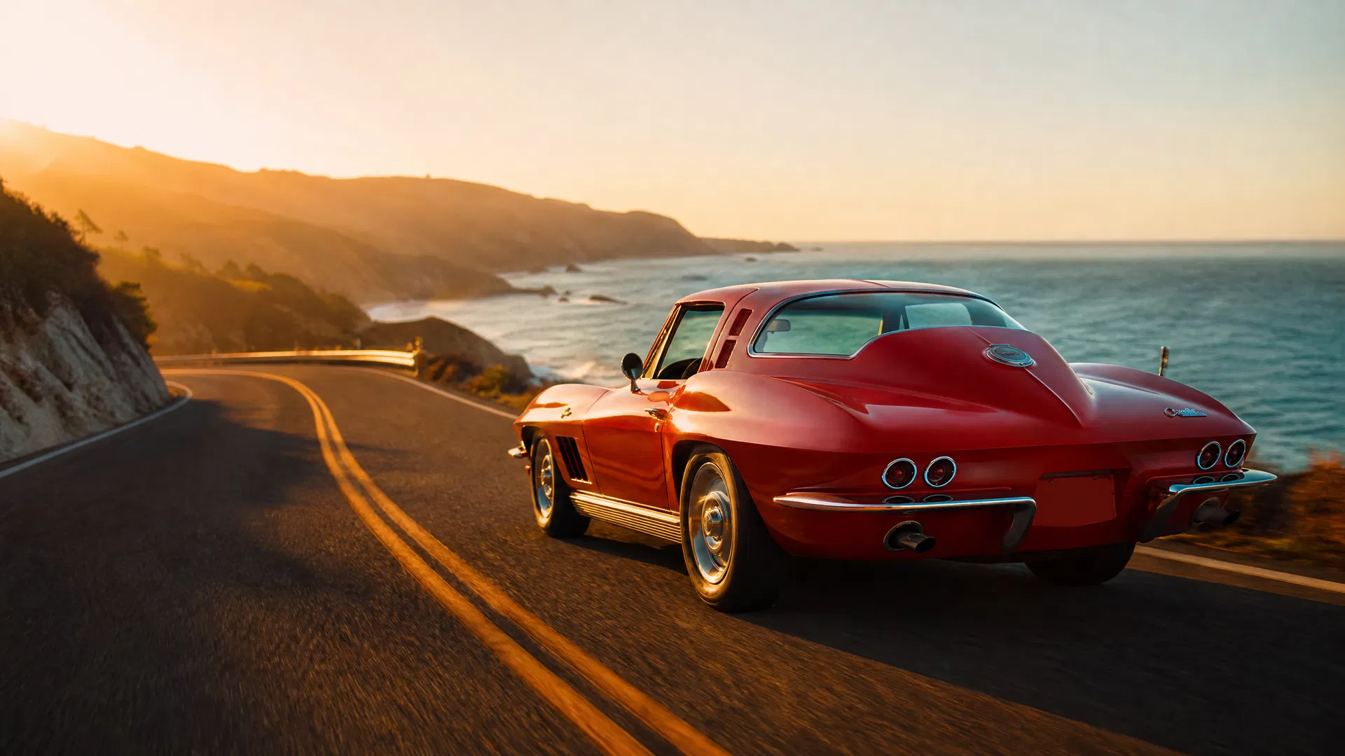

The United States has hundreds of memorable road trips that offer iconic stops, natural wonders, and historic Americana at every turn. But not all of them are created equal - especially if the car you're driving, the road beneath it, and where you sleep at night matter as much as the destination itself. This guide curates the most rewarding US road trips for drivers who think in corners, surfaces, and golden-hour departures.
TL;DR
This guide is built for drivers first, tourists second. Every route is evaluated for road quality, rhythm, and the character of overnight stops - not just headline sights. Coverage spans both iconic drives (Route 66, Blue Ridge Parkway, Pacific Coast Highway) and refined regional loops through California wine country, the Appalachian mountains, the Florida Keys, Glacier National Park, the Alaska Highway, and more. A dedicated section helps you match the right trip to your car, season, and time budget - from 3-day getaways to 2–3 week cross country road trips. Browse The Stable's Drive Packs for curated US driving itineraries.
Why the Great American Road Trip Still Matters in 2026
The road trip has been woven into American identity since the 1920s, when Model Ts first rattled along dirt roads connecting farm towns and big cities. Routes like Route 66 - the mother road spanning 2,448 miles from Chicago to Santa Monica - weren't built as scenic drives. They were lifelines. But over a century, they evolved into something richer: pilgrimages for enthusiasts drawn to vintage Americana and roadside attractions, rock n roll diners, and the sheer act of covering ground under your own power.
Today, the pilgrimage continues on roads like the Pacific Coast Highway, the Blue Ridge Parkway, and Going-to-the-Sun Road - but today's driver expects more. Surface quality, the rhythm of linked corners, and a design-forward inn with secure parking at the end of the day matter as much as any overlook. The rest of this guide is written from a driver's perspective first, tourist second.
How to Choose the Right US Road Trip for Your Car and Time Budget
Not every route suits every car or schedule. A low-slung GT that thrives on smooth coastal California tarmac will suffer on the gravel stretches of the Alaska Highway. An EV that breezes through the Bay Area's dense charging network will need careful planning through remote desert corridors.
Match the route to the vehicle:
- Low-slung sports cars and GTs: smooth mountain parkways (Blue Ridge Parkway, Going-to-the-Sun Road), coastal highways (Pacific Coast Highway, US-101), and well-maintained scenic routes through the Rocky Mountains.
- Rugged SUVs and higher-clearance GTs: Alaska Highway, remote desert loops, dirt road approaches to hot springs, and mixed-surface backcountry.
- Performance EVs: dense charging corridors along California's coast, the Northeast, and growing Pacific Northwest networks. Be cautious in remote zones where public charging is sparse.
Match the route to your time:
| Time Budget | Route Style | Examples |
|---|---|---|
| 3–4 days | Regional loop or single corridor | Blue Ridge section, Colorado Springs loop, Florida Keys |
| 7–10 days | Multi-region journey | California road trip PCH loop, Montana & Glacier combo |
| 14–21 days | Cross country road trips | Coast-to-coast linking multiple regions |
For scenic two-lane roads, 150–250 miles per day is ideal. On interstate-heavy days, 250–350 miles is manageable, but mix in rest days to keep the trip from feeling like logistics. For a deeper dive into planning a US road trip itinerary, see our dedicated guide.
Iconic Coastlines: Pacific Coast Highway and the West Coast Classics
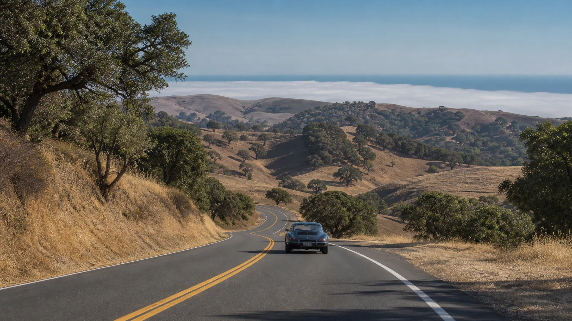
California's Highway 1 and US-101 are the quintessential ocean-side drives for enthusiasts who love sweeping corners and horizon-wide views. The Pacific Coast Highway stretches roughly 1,600 miles from San Diego to Seattle when combined with its northern extensions, but its California spine - 655 miles of coastal road - is where the magic concentrates.
Pacific Coast Highway: Big Sur and the Classic California Road Trip
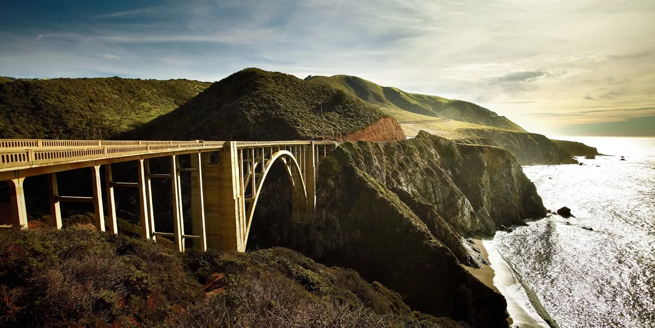
The heart of any California road trip is the stretch between Carmel-by-the-Sea and San Simeon. This is the Big Sur coast: cliff-hugging tarmac, constant ocean views, and a road that demands your attention through every corner. A key segment of Highway 1 was fully restored and reopened on January 14, 2026, after three years of closures due to landslides.
Must-see stops:
- Bixby Creek Bridge - the iconic single-span arch
- Pfeiffer Big Sur State Park for redwood groves and short hiking trails
- McWay Falls, an 80-foot waterfall dropping onto a cove beach
- Hearst Castle near San Simeon for a dose of historic sites and architectural excess
For dining, Sierra Mar at Post Ranch Inn remains one of the finest meals on the California coast. Drive early morning or golden hour for lighter traffic, and plan refuelling in Monterey or Cambria - there's a roughly 110-mile gap between Bixby Bridge and Cambria where EV chargers and fuel stops are sparse.
Pair this with inland wine-country detours through Paso Robles or Santa Ynez for a longer loop. The Stable's Central Coast Crossing Drive Pack covers exactly this kind of pairing. For a focused Big Sur experience, the Big Sur Classic Drive Pack is the definitive guide.
Redwoods to Crater Lake: Northern California into Southern Oregon
Start in the Redwood National and State Parks on the northern California coast, where redwood trees tower hundreds of feet above a narrow, cathedral-like road. Highway 101 runs the entire length of the Oregon Coast and serves as the main artery for this region, but the real character comes from side routes like the Avenue of the Giants.
From the coast, cut inland via US-199 or I-5 towards Mt. Shasta, picking up the Volcanic Legacy Scenic Byway north to Crater Lake National Park. The 33-mile Rim Drive is a bucket-list loop - smooth, flowing, and framed by one of the deepest and bluest lakes on the planet. Seasonal opening is typically late June to October depending on snow.
Suggested overnights (4–6 days):
- Trinidad or Eureka for coastal character
- Mount Shasta City for mountain views and fly fishing on the upper Sacramento River
- A boutique lodge near Crater Lake or in Ashland, Oregon
The contrast between salt-washed redwood groves and high-elevation volcanic rims makes this one of the west coast's most underrated itineraries. The Stable's NorCal Redwoods & Lost Coast Drive Pack covers the northern California section in detail.
Columbia River Gorge and the Pacific Northwest Loop
Start in Portland and head east on I-84 and the Historic Columbia River Gorge Highway - a road built in 1913 that still feels like it was designed for small sports cars. Key stops: Multnomah Falls (620-foot cascade), Vista House at Crown Point, Rowena Crest for one of the most photographed hairpin sequences in the Northwest.
Extend the loop north to explore the Olympic Peninsula: Hurricane Ridge offers alpine views above the Strait of Juan de Fuca, the Hoh Rain Forest delivers moss-draped old growth, and the Sol Duc Valley provides hot springs surrounded by temperate rainforest. The Stable's Columbia Gorge & Cascade Volcanoes Drive Pack covers this region in depth.
Mountain Epics: Appalachians, Rockies, and High-Country Drives
Mountain roads are the natural habitat of driver's cars. Elevation changes, linked corners, and views that open and close with every switchback create a rhythm that flat highways simply can't replicate.
Blue Ridge Parkway: Through the Heart of the Appalachian Mountains
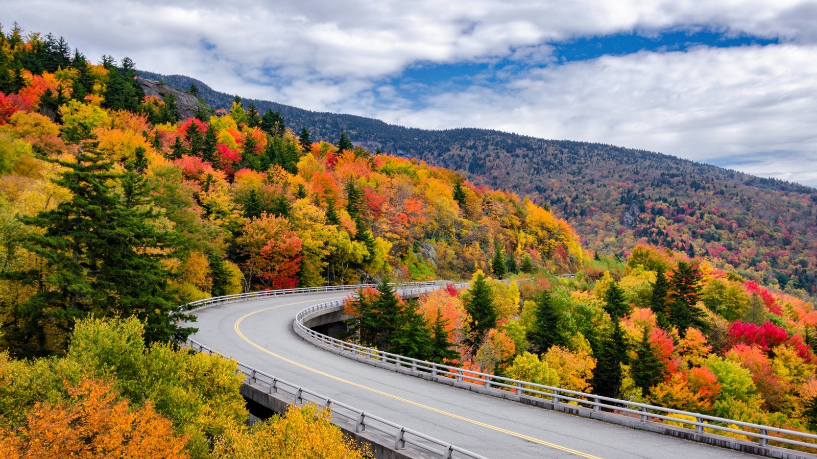
The Blue Ridge Parkway spans 469 miles linking Shenandoah National Park in Virginia to Great Smoky Mountains National Park in North Carolina. Known as "America's Favorite Drive," it is celebrated for its lush mountain overlooks, rolling hills, and a no-billboard policy that keeps the scenery pure. The speed limit is 45 mph throughout, which keeps traffic calm and the drive meditative.
Best segments:
- Mabry Mill (milepost 176) - the most photographed structure on the Parkway
- Craggy Gardens (milepost 364) - rhododendron blooms in June
- Linn Cove Viaduct (milepost 304) - engineering marvel hugging Grandfather Mountain
The Stable's Appalachian Grand Tour Drive Pack covers the best driving segments of the Blue Ridge Parkway with curated overnight stops and dining recommendations.
Colorado and the Rocky Mountain High-Country Loop
Colorado's mountain roads are among the most technically demanding and visually dramatic in the lower 48. The San Juan Skyway - a 236-mile loop through Durango, Silverton, Ouray, and Telluride - is the crown jewel. Million Dollar Highway (US-550) between Silverton and Ouray is a 25-mile stretch of cliff-edge switchbacks with no guardrails and views that stop conversation mid-sentence.
Trail Ridge Road in Rocky Mountain National Park reaches 12,183 feet - the highest paved through-road in the US. It typically opens in late May and closes in October. The Colorado High Country Drive Pack from The Stable covers the best of Colorado's mountain driving.
Glacier National Park and the Going-to-the-Sun Road
Going-to-the-Sun Road is 50 miles of mountain driving that crosses the Continental Divide at Logan Pass (6,646 feet). It's one of the most dramatic roads in North America - narrow, cliff-edged, and framed by glacially carved peaks. Vehicles over 21 feet are prohibited between Avalanche Creek and the Sun Point parking area. The road typically opens fully in late June and closes in October.
The Stable's Going-to-the-Sun Road Drive Pack pairs this iconic road with the best of Glacier National Park's surrounding drives. For a broader Montana and Wyoming loop, the Beartooth & Yellowstone Drive Pack combines Going-to-the-Sun with Beartooth Pass and Yellowstone.
Historic Routes: Route 66 and the Great American Highways
Route 66 - the original Main Street of America - runs 2,448 miles from Chicago to Santa Monica. The road no longer exists as a continuous federal highway, but it survives as a series of historic byways through Illinois, Missouri, Kansas, Oklahoma, Texas, New Mexico, Arizona, and California.
Best segments:
- Oklahoma: the longest continuous stretch of original Route 66 pavement
- Arizona: Petrified Forest, Painted Desert, and the Wigwam Motel in Holbrook
- New Mexico: Santa Fe detour, Acoma Pueblo, and the Turquoise Trail
The Lincoln Highway - America's first transcontinental road, established in 1913 - runs 3,389 miles from New York to San Francisco. Less celebrated than Route 66 but equally rich in roadside history, it passes through Pennsylvania's Amish country, the Nebraska Sandhills, and the Nevada desert.
Southern Comfort: The Florida Keys, Gulf Coast, and Natchez Trace
The Florida Keys: US-1 from Miami to Key West
The Overseas Highway (US-1) runs 113 miles from Florida City to Key West across 42 bridges, including the Seven Mile Bridge. The drive is flat and straight, but the surrounding water - turquoise, shallow, and dotted with mangrove islands - is extraordinary. The Stable's Florida Keys Overseas Highway Drive Pack covers the full length with curated stops and overnight recommendations.
The Gulf Coast and Natchez Trace Parkway
The Natchez Trace Parkway runs 444 miles from Natchez, Mississippi to Nashville, Tennessee. Like the Blue Ridge Parkway, it prohibits commercial vehicles and has no traffic lights - making it one of the most serene long-distance drives in the South. The road follows the historic path used by Native Americans, settlers, and boatmen returning north after floating goods down the Mississippi.
The Alaska Highway: North America's Ultimate Road Trip
The Alaska Highway runs 1,387 miles from Dawson Creek, British Columbia to Delta Junction, Alaska. It was built in 1942 as a military supply road and remains one of the most remote, demanding, and rewarding drives in North America.
Practical notes:
- Best driven June through August; September brings early snow at higher elevations
- Fuel stops can be 100+ miles apart; carry extra fuel
- Gravel sections remain, particularly in Yukon; higher-clearance vehicles preferred
- Wildlife encounters (bears, bison, moose) are frequent and require caution
Planning Your US Road Trip with The Stable
The Stable's Drive Packs cover the most rewarding US driving regions - California's coast and wine country, the Pacific Northwest, the Rocky Mountains, and the Southeast. Each pack includes curated multi-day itineraries with Rally Point navigation, dining recommendations, car-forward accommodation suggestions, and seasonal notes.
For a comprehensive overview of planning a road trip across the US, our dedicated guide covers route selection, daily mileage targets, budgeting, and vehicle preparation. If you're looking for the best road trip planning tools, we've reviewed the top options for enthusiast drivers.
For drivers who want a fully custom US road trip - a specific route, a specific car, a specific set of experiences - the bespoke planning service builds the itinerary from scratch.
Frequently Asked Questions
Do I need a permit to drive Going-to-the-Sun Road?
Vehicles over 21 feet require a permit to drive between Avalanche Creek and the Sun Point parking area. Passenger cars do not require a permit, but the road does have vehicle size restrictions. Check the National Park Service website for current conditions and any timed-entry requirements.
What's the best time of year for a US road trip?
Spring (April–June) and fall (September–October) offer the best combination of weather, crowd levels, and road conditions for most regions. Summer is peak season for mountain roads (most passes open June–July) but brings heavier traffic. Winter is ideal for the southern routes (Florida Keys, Gulf Coast, southern California).
How many miles per day should I plan?
For a scenic, driver-focused road trip: 150–250 miles per day on two-lane roads, 250–350 on interstate-heavy days. Build in at least one rest day per week for longer trips.
Can I drive a classic car on the Alaska Highway?
Yes, but with preparation. The Alaska Highway has gravel sections, remote fuel stops, and significant wildlife. A well-maintained classic with good ground clearance and a spare parts kit is feasible; a low-slung sports car is not recommended.
What's the most underrated US road trip?
The Natchez Trace Parkway is consistently underrated - 444 miles of no-commercial-traffic, no-traffic-light driving through Mississippi, Alabama, and Tennessee, with historic sites, Civil War battlefields, and exceptional Southern food along the way.
Conclusion
The United States has more exceptional driving roads than any single trip can cover. The Pacific Coast Highway, the Blue Ridge Parkway, Going-to-the-Sun Road, the San Juan Skyway, the Natchez Trace - each one rewards the driver who approaches it with curiosity, preparation, and a car worth driving.
Browse The Stable's Drive Packs for curated US driving itineraries, explore the Journal for regional guides and road stories, or reach out about a bespoke build if you have a specific route in mind.