Choose a scenic corridor based on season and trip length, then map 20–30 waypoints including byways, viewpoints, and fuel stops on remote stretches. Cap daily driving at 5 hours and 150–250 miles to leave time for hikes and small towns. Budget for slower speeds burning 10–20% more fuel, grab an America the Beautiful pass if visiting multiple parks, and always download offline maps before entering low-coverage zones.
Determining your travel goals is the first step in planning a road trip, as it helps shape your route, stops, and overall experience. This guide is designed for travelers seeking to maximize their road trip experience by exploring scenic routes and hidden gems. Careful planning ensures you experience the most beautiful drives, avoid common pitfalls, and create lasting memories. Our scenic route road trip planner helps you set the course for your journey, ensuring a well-structured and memorable trip.
This is a practical guide for anyone ready to plan road trips across America in 2026, prioritizing back roads, small towns, and stretches of highway that actually reward the time spent behind the wheel. You will learn how to choose a scenic route, map multiple stops, estimate driving time, and stay prepared for whatever the great outdoors throws your way. When using a scenic route road trip planner, you do not need to enter your exact home address—using a nearby city or general location is sufficient. This approach helps protect your privacy and adds flexibility to your planning.
Whether you are plotting a June 2026 Pacific Coast Highway drive from San Diego to San Francisco or a September 2026 Blue Ridge Parkway leaf-peeping trip through Appalachia, this guide walks you through the process from first idea to completed itinerary.
What this guide covers:
- Choosing a scenic corridor based on season and trip length
- Mapping 20+ waypoints without slowing down your planning
- Building a day by day itinerary with realistic driving windows
- Budgeting for fuel costs, park passes, and lodging
- Staying safe on remote stretches with limited cell coverage
Introduction to Road Trips
Embarking on a road trip is one of the most exciting ways to explore the country and experience the great outdoors. Whether you're planning a cross-country adventure or a weekend getaway, a road trip offers the freedom to create your own journey, discover new locations, and make unforgettable memories along the way. Using a road trip planner can simplify the process, helping you map out your route, estimate fuel costs, and identify essential stops such as gas stations, scenic viewpoints, and national parks. With a detailed road trip map in hand, you can maximize your driving time, avoid unnecessary detours, and ensure you're always prepared for the next leg of your trip. No matter your preferences or experience level, careful planning allows travelers to make the most of every mile, turning the process of getting there into an adventure all its own.
What is a scenic route road trip planner?
A scenic route road trip planner is a tool and method for building itineraries that prioritize views, attractions, and experiences over the shortest driving time. Instead of routing you down an interstate at 75 mph past truck stops and chain restaurants, a good planner surfaces back roads, national scenic byways, and detours through towns worth a walk.
Scenic routes often include iconic natural landmarks and beautiful landscapes, making the journey itself a memorable experience.
Classic drives that absolutely benefit from this approach include:
- Route 66 from Chicago to Santa Monica
- Highway 1 along the California coast
- The Great River Road following the Mississippi
- The Overseas Highway linking the Florida Keys
These routes exist to be savored, not rushed.
This differs from generic GPS navigation. Google Maps and similar apps optimize for speed, not scenery. A scenic route road trip planner provides detailed directions, offering turn-by-turn navigation and route guidance to help travelers efficiently explore scenic byways and points of interest along the way. A dedicated trip planner combines a road trip map with points of interest, gas stations, lodging options, and offline access for areas where cell signal disappears. Think of it as a program designed for travelers who believe the journey matters as much as the destination.
Now that you understand what a scenic route road trip planner is, let's move on to how to choose your perfect scenic route.
How to choose your perfect scenic route
Selecting your main corridor comes down to regional focus, time of year, and personal preferences. Here is how to determine the right fit for your 2026 adventure:
Regional Focus and Preferences
- Consider a 10 day July 2026 loop from Denver through Rocky Mountain National Park, Million Dollar Highway, and Mesa Verde for mountain drama — our Colorado High Country drive pack covers this corridor
- Plan a 5 day spring Texas Hill Country drive in March or April to catch the wildflower bloom along FM roads
- Decide between coastal, mountain, desert, or countryside routes based on your comfort with winding roads and elevation changes
- Avoid problem seasons: skip Beartooth Highway in May due to snow, and reroute around the Outer Banks in September when hurricane risk peaks
A good scenic route road trip planner can answer common questions about route selection, such as the best time to travel or which regions offer the most scenic experiences.
Seasonal Considerations
Timing shapes everything on scenic routes. High mountain passes close for winter, desert roads become dangerous in summer heat, and foliage peaks last only a few weeks.
Season and destination combinations for 2026:
- April through October: Blue Ridge Parkway at its best, with spring blooms and fall color
- July through September: Going-to-the-Sun Road in Glacier National Park, typically opening in early July once snowpack clears
- Early June: Oregon Coast before summer crowds arrive
- Late September: Colorado aspens at peak color between 9,000 and 11,000 feet elevation
- March through April: Texas Hill Country wildflowers, peaking after 2+ inches of spring rain
A good scenic route road trip planner should display seasonal closure warnings and surface these notes automatically so you do not plan a May visit to a road that will not open until July.
Sample Scenic Routes
Trip duration shapes your route more than anything else. Here is how to figure the right pace:
- 3 to 4 days: San Francisco to Big Sur loop, roughly 250 miles of concentrated coastal beauty
- 7 to 10 days: Seattle to Yellowstone, covering 900 miles at 150 miles per day
- 2+ weeks: Coast to coast journey, approximately 3,000 miles with time to explore
On scenic roads, plan for 150 to 250 miles per day maximum. These routes feature curves, viewpoints, and towns that demand your attention. Cap daily wheel time at 5 hours to save energy for short hikes and spontaneous stops.
Your trip planner should visually display each day's segment and estimated duration so you can identify rushed days before they happen.
Once you've selected your ideal route, the next step is to map out your journey with multiple stops.
Mapping your scenic route with multiple stops
This is where the route takes shape. The process involves selecting scenic roads, adding must-see sights, and spacing services along rural stretches where gas stations and food options grow sparse.
Adding Stops and Waypoints
- Accept a starting city and final destination, then add 20 to 30 intermediate scenic stops
- Include overlooks along Skyline Drive in Shenandoah (105 miles with 75 vistas)
- Drop pins on ghost towns along Route 66 in Arizona like Oatman and Jerome
- Space refuel and food stops every 100 to 150 miles on remote segments
Many scenic route road trip planners provide a link to each stop's map location or official website, making it easy to access more information about each destination. Detailed trip planning articles and expertly curated driving weekend itineraries often include links to relevant pages for destinations, activities, or accommodations, helping travelers plan each segment of their journey more efficiently.
Prioritize Scenic Byways and Lesser Known Roads
National Scenic Byways and All-American Roads represent the best of what this country offers for driving, much like other curated driving experiences and scenic routes that focus on the joy of the journey itself. These designations from the U.S. Department of Transportation identify routes with exceptional vistas, history, or recreation.
Key byways to explore:
- Utah Scenic Byway 12: 123 miles through red rock canyons
- Blue Ridge Parkway: 469 miles through Appalachia
- Overseas Highway: 113 miles linking the Florida Keys
- Pacific Coast Highway: 656 miles from San Diego to Leggett
Your planner should enable you to toggle an option avoiding major highways where feasible. For example, rerouting a West Coast drive from Interstate 5 to US Highway 101 adds 2 to 3 hours but delivers coastal views, redwood groves, and beach access that make the extra distance worthwhile.

Add Viewpoints, Hikes, and Small Towns as Waypoints
A scenic road trip is more than windshield time. Build in stops that get you out of the vehicle:
- Maroon Bells near Aspen: 1.9 mile trail with iconic twin peaks
- Devils Tower in Wyoming: 1.3 mile walk around the base
- Bar Harbor on the Maine coast: walkable downtown with lobster rolls
- State park overlooks with parking, restrooms, and 30 minute visit times
Keep stops realistic. Limit each day to 3 to 5 major scenic activities so you can actually enjoy them rather than rushing through a checklist.
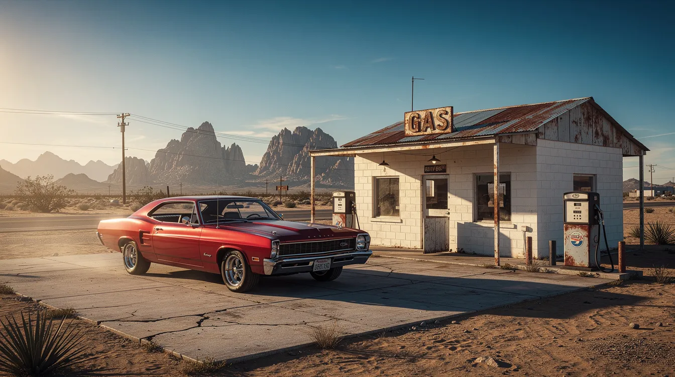
Plan Fuel, Food, and Restroom Breaks on Remote Stretches
Some of America's most beautiful roads pass through areas with limited services. Plan ahead or risk getting stranded.
Remote stretches requiring careful fuel planning:
- US 50 in Nevada, the "Loneliest Road": 287 miles between Tonopah and Ely with minimal stops
- Big Bend region in Texas: 100 mile gaps between gas stations
- Utah corridor from Moab to Torrey: 120 miles through red rock desert
- Death Valley in summer 2026: fill your tank before entering, with 120 miles to Furnace Creek
Your planner should flag critical refuel points and let you store this information offline in case cell signal disappears.
With your stops mapped out, it's time to explore the digital tools that can make planning your scenic route even easier.
Digital Tools and Apps for Scenic Route Planning
A variety of digital tools and apps are available to help you plan the perfect scenic route road trip, each offering unique features for mapping scenic routes and points of interest:
- Google Maps: Widely used for route planning, Google Maps allows you to enter your starting point, destination, and multiple stops. It helps you locate gas stations, restaurants, and attractions along your route, and provides real-time traffic updates.
- Roadtrippers: Specifically designed to help travelers find points of interest and scenic stops along a route. Roadtrippers makes it easy to discover hidden gems, unique attractions, and off-the-beaten-path experiences.
- AAA TripTik: This tool helps you plan road trips to millions of destinations. You can enter your starting point and destination to map your route, get turn-by-turn directions, and access recommendations for hotels, attractions, and fuel stops.
- MyRouteOnline: A versatile tool that helps travelers optimize their travel itineraries by efficiently mapping out routes. MyRouteOnline excels in managing complex travel itineraries with multiple stops and offers advanced route optimization to simplify the process.
- Take Back Roads: Offers a service to help plan road trips by creating detailed maps based on user preferences. Take Back Roads provides options for both detailed and basic road trip plans, focusing on scenic and less-traveled routes.
- WilderTrips: Designed for planning multi-day road trip adventures, WilderTrips helps you organize your journey, map out scenic segments, and manage your itinerary for longer trips.
These tools can be used individually or in combination to create a customized scenic route road trip planner that matches your travel style and goals. For a deeper dive into route optimization, see our guide on how to map a trip and optimize every mile.
With your digital tools selected, you're ready to build a day-by-day scenic road trip itinerary.
Exploring National Parks
No road trip is complete without a visit to at least one national park. For travelers who crave adventure and the beauty of the great outdoors, national parks offer endless opportunities for exploration, from hiking and camping to scenic drives and wildlife spotting. With a national park pass, you and your family or friends can access over 2,000 federal recreation sites, making it easy to create a trip that's both fun and affordable. A road trip planner can help you determine which parks to visit based on your route and interests, ensuring you don't miss out on must-see destinations. Whether you're pitching a tent under the stars, taking in breathtaking vistas, or simply enjoying quality time together, incorporating national parks into your road trip itinerary guarantees a memorable adventure for everyone. Let your trip planner guide you to the best parks and activities, and make every stop a highlight of your journey.
Building a day by day scenic road trip itinerary
Here is where the high level route becomes a practical calendar with days, overnights, and activities, especially if you enjoy pairing scenic drives with curated car-friendly stays.
Example: 5 day Portland to San Francisco coast trip
- Day 1: Portland to Newport, 150 miles, overnight Newport
- Day 2: Newport to Coos Bay, 100 miles
- Day 3: Coos Bay to Eureka, 200 miles
- Day 4: Eureka to Mendocino, 150 miles
- Day 5: Mendocino to San Francisco
Each day plan should include estimated driving time, 2 to 3 scenic stops, and evening arrival at a town with character. Additionally, more detailed scenic route road trip planner itineraries can provide route explanations and recommended stops, which basic plans may not include.
Choose Overnight Stops in Character Rich Towns
Skip the interstate exit hotels. Prioritize towns with walkable centers and local flavor:
- Hood River, Oregon: windsurfing hub with 20+ lodging options
- Durango, Colorado: historic train depot surrounded by mountains
- Fredericksburg, Texas: wine country charm with B&Bs and local restaurants
- Southwest loop overnights: Flagstaff, Page, and Moab offer excellent base camps
Your planner should display lodging clusters so you can locate areas with multiple motel, hotel, or campground choices.
Balance Drive Time with Exploration
The best planning rule for scenic trips: no more than 5 hours of driving plus one major activity per day. Spend a morning on Trail Ridge Road (48 miles, 3 hours at scenic pace), then dedicate the afternoon to a short hike.
Build in flex days where you can linger if weather cooperates or a town captures your interest. The anticipation of what is around the next bend is half the fun.
Lock in Reservations Where It Matters
Some scenic areas require advance booking for any 2026 visit:
- Yellowstone lodges: book 13 months ahead for summer, with 90% occupancy Memorial Day through Labor Day
- Yosemite: similar timeline for in-park lodging
- Banff via Parks Canada: reservations open in January for summer trips
Mark nights where advance bookings are crucial versus nights where you can stay flexible. Attach confirmation numbers and notes to specific overnight waypoints so everything stays organized in one place.
With your itinerary in place, it's important to consider budgeting and logistics for your scenic road trip.
Budgeting and logistics for scenic road trips
Beautiful routes often mean slower speeds and slightly higher costs. Winding roads at 45 to 55 mph burn 10 to 20% more fuel than straight interstates. Planning ahead keeps surprises manageable. For the most accurate and up-to-date information on fuel prices, tolls, and booking requirements, always check the official website of each destination or service provider before your trip.
Estimating Fuel and Toll Costs
Combine route distance, vehicle fuel efficiency, and regional gas prices:
- 2026 gas projections: approximately $3.40 per gallon West Coast, $3.20 Midwest
- Mid-size SUV at 25 mpg on a 1,500 mile loop: roughly $210 in fuel
- Eastern Seaboard tolls can add $20 or more on certain turnpikes
- San Francisco Bay bridges run $7 to $10 each
Your road trip planner should show where toll free alternatives exist, often scenic local roads running parallel to interstate segments.
Park Passes and Entrance Fees
For travelers visiting several national park sites in 2026, the America the Beautiful Annual Pass ($80) pays for itself quickly. A Utah Mighty 5 loop covering Zion, Bryce Canyon, Capitol Reef, Canyonlands, and Arches would cost $150+ in individual entry fees.
State parks add separate per vehicle fees, typically $5 to $15. Flag fees in your planner so they appear in your daily budget estimate.
Lodging Options
Back road routes pair well with:
- National park campgrounds: $30 to $50 per night, book via recreation.gov 6 months ahead
- Vintage Route 66 motels: $80 to $120 with authentic character
- Vermont farmhouse stays: $150 for a memorable night
- Mix of camping and hotels to maximize budget flexibility
Track each overnight as hotel, campground, RV park, or rental so you can see budget categories at a glance, and pair it with the right driving and travel essentials to keep your setup comfortable and your vehicle road-ready.
With your budget and logistics sorted, it's time to focus on staying safe and flexible on scenic back roads.
Staying safe and flexible on scenic back roads
The most beautiful routes sometimes come with challenges. Limited cell coverage, wildlife crossings, and sudden weather changes demand preparation.
Vehicle Preparation
Before any mountain or desert drive, complete a pre-trip inspection:
- Check brakes and tires for steep descents like Colorado's Million Dollar Highway (8% grades)
- Verify coolant levels for hot desert stretches
- Carry extra water in remote regions like the Mojave
- Store AAA membership info offline for 100 mile tow coverage if needed
Offline Navigation
Many stunning areas have limited cell signal: parts of Glacier National Park, Big Bend, and remote Canadian parks will leave your phone useless for navigation.
- Download offline maps before entering low coverage zones
- Print a basic route overview as backup
- Save GPX files that work without data connection
A good planner should flag known low coverage segments and prompt you to download those areas in advance.
Weather and Detour Planning
Common closure types to account for:
- Snow closures: Going-to-the-Sun Road and Tioga Pass often remain closed until early July
- Wildfire diversions: affects 20% of Western routes annually
- Flooding along coastal roads after storms
Always have at least one alternative scenic route or rest day built into your plan for key high elevation segments. If late snow lingers in May, reroute from Yellowstone's high passes to lower elevation alternatives and return another year.
With safety and flexibility in mind, you're ready to turn your scenic route road trip plan into reality.
Customizing Your Road Trip Experience
Every traveler's ideal road trip looks a little different, which is why customizing your itinerary is key to a truly enjoyable adventure. With a road trip planner or trip planner app, you can easily identify stops and activities that match your interests—whether that means sampling local cuisine, exploring historic landmarks, or taking a scenic walk through a charming town. For culinary inspiration along the way, explore our food and wine tours guide. These tools help you locate hotels, gas stations, and other essential services along your route, providing directions and maps to keep your journey on track. Additionally, many road trip planners offer features like fuel cost estimates, driving time calculations, and real-time traffic updates, allowing you to optimize your route and make the most of every day. By tailoring your trip to your preferences and needs, you'll create a fun, stress-free experience that's uniquely yours—one you'll want to relive again and again.
Turning your scenic route road trip plan into reality
A good scenic route road trip planner helps you move from idea to booked trip without losing the spirit of adventure. The major stages are straightforward:
- Choose a scenic corridor
- Map your stops
- Build a day by day itinerary
- Set a realistic budget
- Prepare for safety on remote roads
Start with a specific route in mind. A late summer 2026 Canadian Rockies journey. A spring 2026 Southwest desert loop. A first time drive down Pacific Coast Highway with friends or family.
Begin by outlining just three things in your planner today: start date, starting city, and one must-see scenic segment. The rest will fill in as your ideas take shape.
The best road trips happen when logistics fade into the background and you are free to combine planned stops with unplanned vistas. That is what a thoughtful planner makes possible. Now go create something worth the drive.
We invite you to share your own road trip stories, tips, and photos to inspire others and help build a vibrant community of scenic route enthusiasts. Your user-generated content helps our site grow and improves the experience for all travelers. We also use analytics data to enhance the site's features and usability.
Drives From This Story
Hit the road on a route inspired by this article.
 CaliforniaMember Access
The Big Sur Classic
Where the Mountains Meet the Pacific
 North Carolina / VirginiaMember Access
Appalachian Grand Tour
America's most beloved scenic road through peak fall color
 Pacific NorthwestMember Access
Oregon Coast
Sea Stacks, Lighthouses & Craft Beer
 Mountain WestMember Access
Colorado High Country
The San Juan Skyway & Million Dollar Highway
 Mountain WestMember Access
Going-to-the-Sun Road
America's Most Spectacular Mountain Road
 TexasMember Access
Texas Hill Country
Barbecue, bourbon, and back roads through the heart of Texas
 Mountain WestMember Access
Beartooth & Yellowstone
The Most Beautiful Drive in America
 FloridaMember Access
Florida Keys Overseas Highway
Island-hopping across turquoise waters on America's most unique road
 Mountain WestMember Access
Utah Red Rock Grand Tour
Through the Most Otherworldly Terrain on Earth
Articles Connexes

Rent a Ferrari in Los Angeles
Los Angeles offers year-round Ferrari-friendly weather, iconic routes like Pacific Coast Highway, Sunset Boulevard, and Mulholland Drive, plus luxury hotspots including Beverly Hills and Malibu. This guide covers where to drive, rental requirements, model options, booking tips, and exclusive services.

Trip Planner Road Book: Plan, Book, and Hit the Highway with Confidence
A trip planner road book is a dedicated digital tool that organizes multi-day, multi-stop driving journeys — handling routes, daily driving limits, overnight stays, attractions, fuel stops, and budgets in one place. This guide covers everything you need to know.

Tours de conduite autoguidés
Les tours de conduite autoguidés sont le moyen ultime de vivre la route ouverte, offrant aux conducteurs la liberté d'explorer à leur propre rythme. Ce guide complet couvre la planification, le budget, la préparation des bagages et les meilleurs itinéraires à travers les États-Unis, le Royaume-Uni et l'Europe pour 2026 et 2027.
Parcourez les routes que vous venez de lire
L'adhésion The Stable arrive bientôt — un abonnement pour chaque itinéraire sélectionné de notre bibliothèque, avec points de rallye détaillés, guides gastronomie & vins et hébergements. À partir de $6.97/mois.